
TROPICAL DEPRESSION DANTE STORMWATCH NO. 01Issued at: 1:00 AM PhT (17:00 GMT) Wednesday, 23 Jul 2025
Next update: 1:00 AM PhT (17:00 GMT) Thursday, 24 Jul 2025 |
|
|---|---|
| Current Status and Outlook |
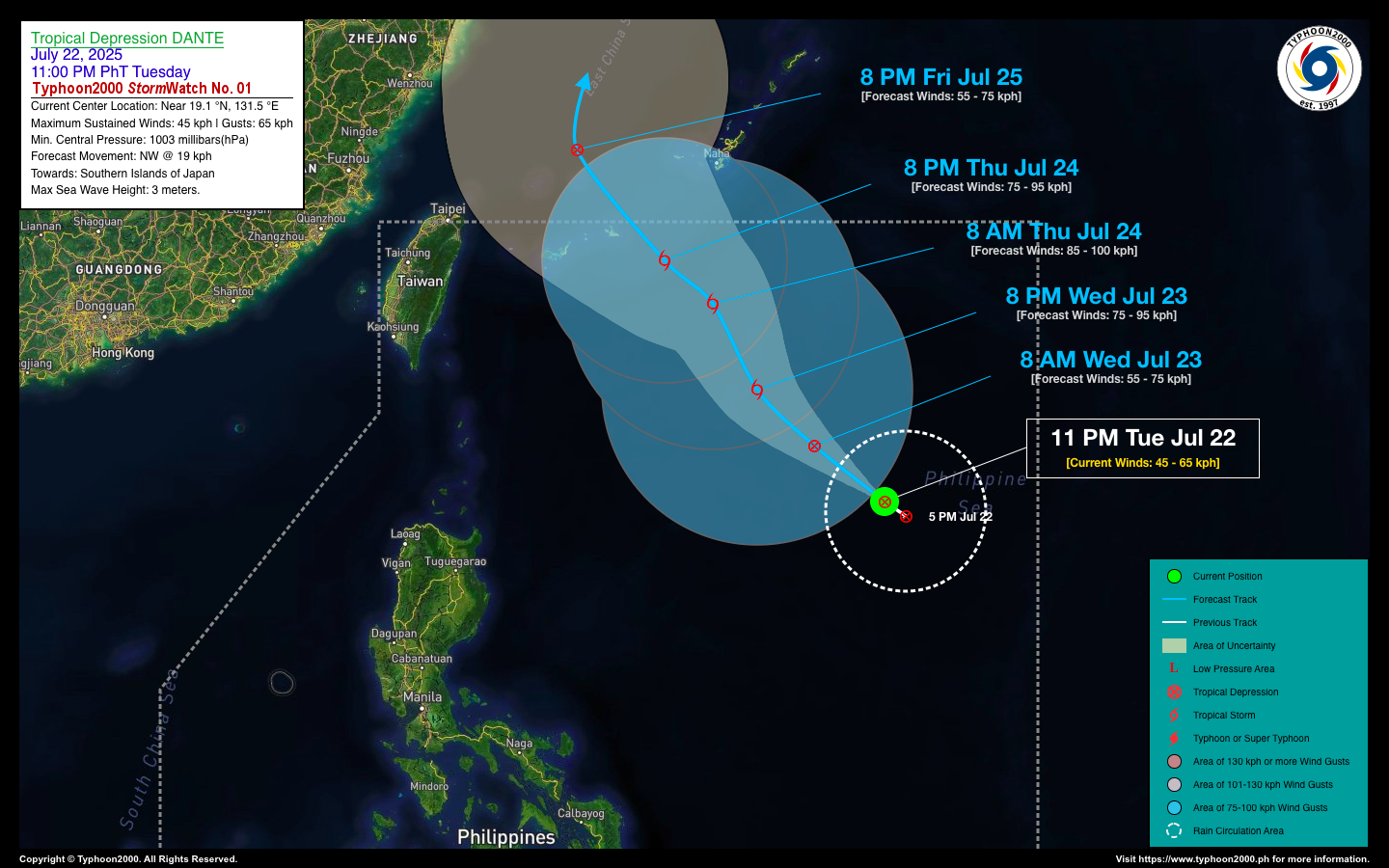
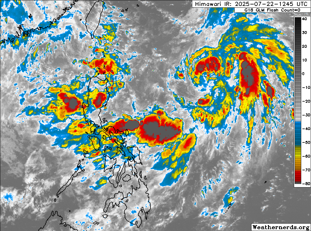
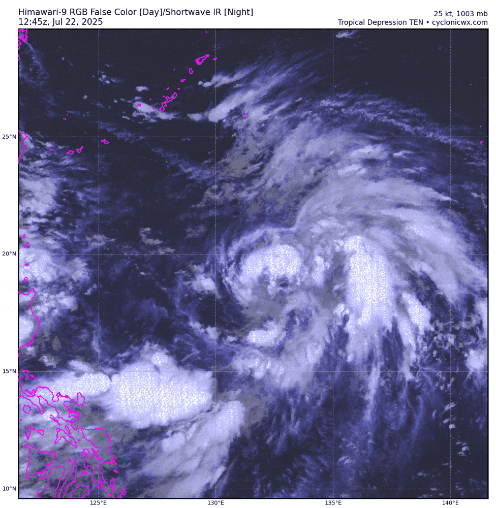
The tropical disturbance over the Western Pacific Ocean, east of Luzon, has developed into Tropical Depression 10W, locally named “DANTE.” While this cyclone is not expected to directly affect the Philippines, it will continue to enhance the Southwest Monsoon (Habagat), bringing occasional light to moderate, and at times heavy to intense rainfall, particularly across the western sections of the country. Meanwhile, a small but intensifying tropical disturbance, 99W, has been detected moving west to west-southwest along the Balintang Channel. This system will be closely monitored for potential development into a tropical cyclone within the next 24 to 48 hours. |
| Where is DANTE? | As of 11:00 PM PhT last night, July 23…1500 GMT:
|
| How strong is it? | Maximum Sustained Winds (1-min avg): 45 kph near the center…Gustiness: 65 kph. |
| Past Movement (06 hrs) | West-Northwest @ 11 kph, towards the North Philippine Sea. |
| Forecast Highlights |
|
| This StormWatch is valid for the next 24 hours.
Information based on data collected by Typhoon2000 (T2k) shall not be taken as official data. Weather information broadcasted and distributed by PAGASA remains as official data. T2k shall not be responsible for the private use and reliance of its weather information. |
|
Issued by: David Michael V. Padua for Typhoon2000 (T2K)


