
TROPICAL STORM CRISING (WIPHA) ADVISORY NO. 04Issued at: 2:00 AM PhT (18:00 GMT) Saturday, 19 Jul 2025
Next update: 2:00 PM PhT (06:00 GMT) Saturday, 19 Jul 2025 |
|
|---|---|
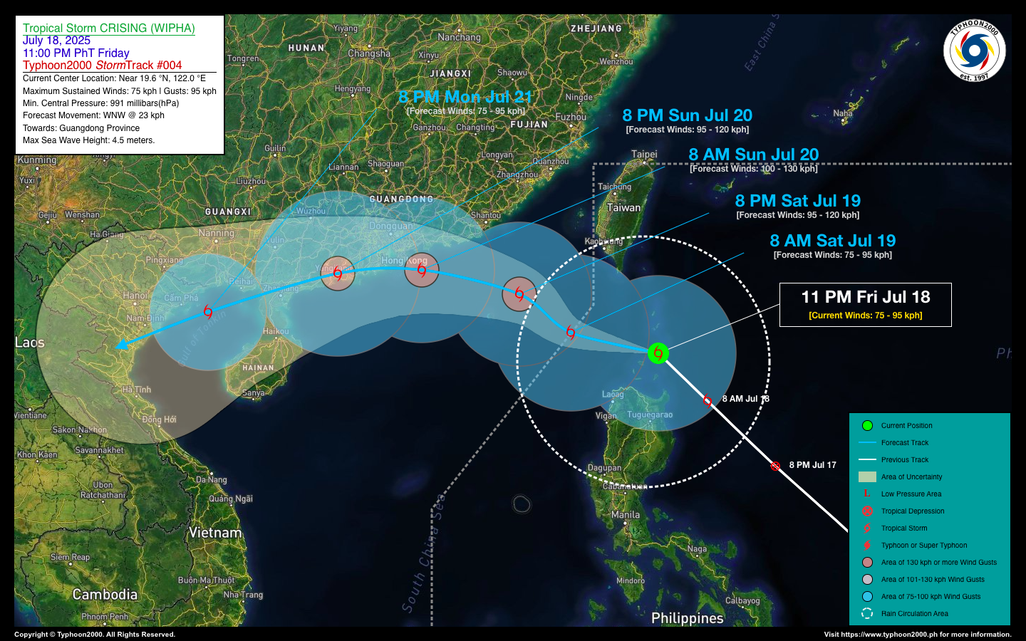
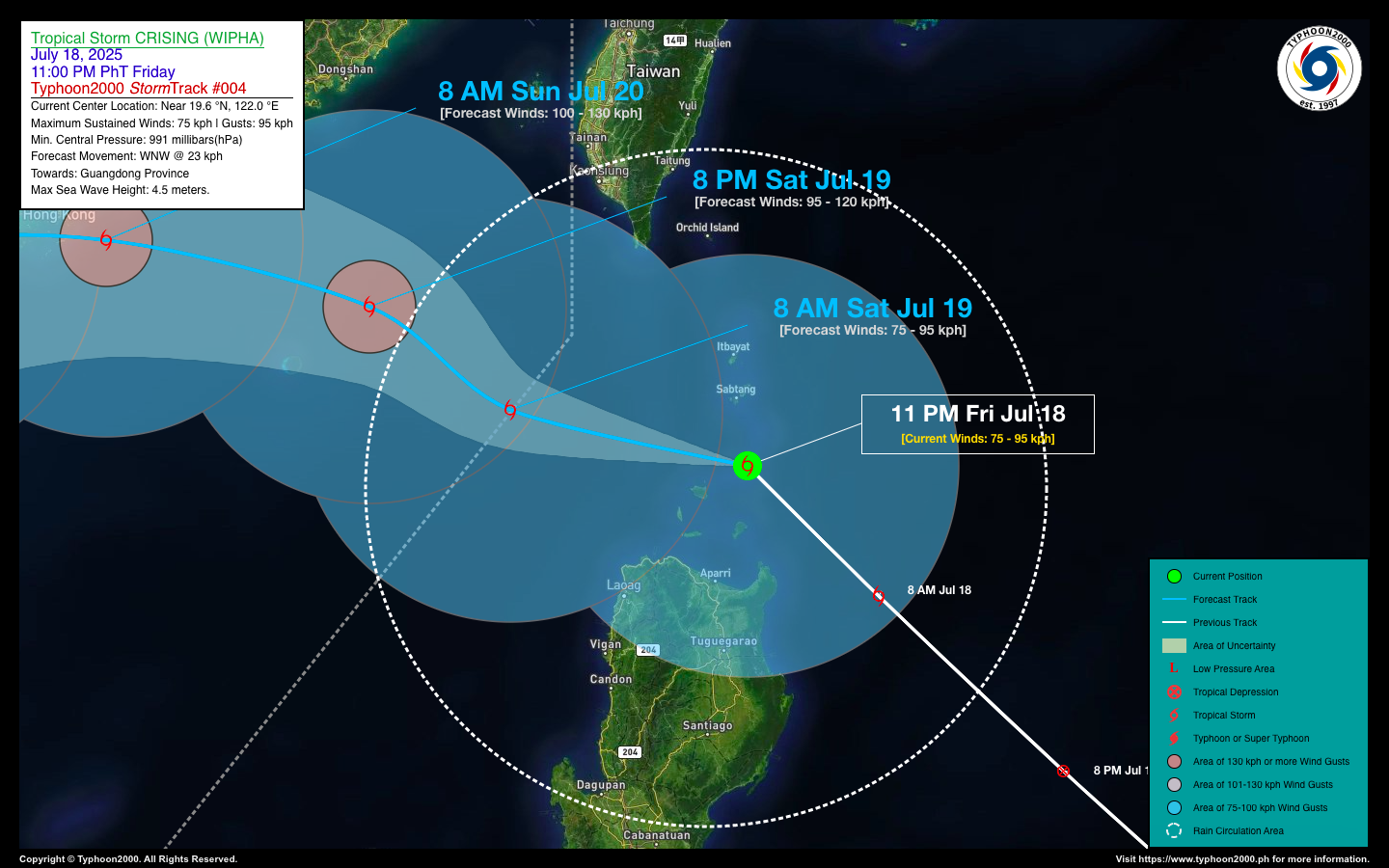
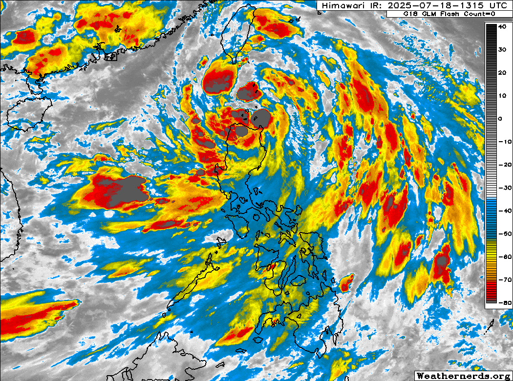
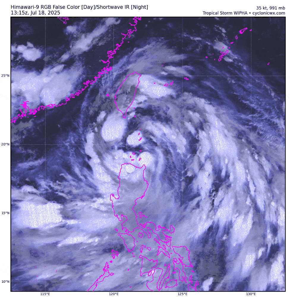
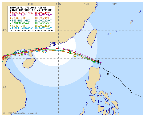
| Current Status & Outlook | Tropical Storm CRISING (WIPHA) is now crossing the Balintang Channel, moving just north of Calayan Island. Strong winds and intense to torrential rains are currently affecting parts of Extreme Northern Luzon. Residents are advised to remain on alert for possible flooding and landslides.
48-hr Outlook: TS CRISING is expected to exit the Philippine Area of Responsibility this morning and may strengthen into a Severe Tropical Storm as it heads toward Southern China. The storm’s core is on track to pass near or directly over Hong Kong by Sunday afternoon, possibly peaking at 100 kilometers per hour, before weakening over the City of Yangjiang by Sunday evening, July 20. The presence of CRISING will continue to enhance the Southwest Monsoon (Habagat), bringing occasional light to moderate, and at times heavy to torrential rains across the western sections of the country—including MIMAROPA, Western Visayas, and Western Luzon—tonight and continuing through the weekend. |
| Where is CRISING (WIPHA)? | As of 11:00 PM PhT last night, Jul 18…1500 GMT:
|
| How strong is it? | Maximum Sustained Winds (1-min avg): 75 kph near the center…Gustiness: 85 kph. |
| Past Movement (06 hrs) | Northwest @ 19 kph, towards Southern China. |
| Potential Philippine Major Landfall Area(s) |
|
| What Philippine areas will be directly affected? | Heavy to Extreme Rainfall (50 mm to >100 mm expected for 24 hrs):
Damaging Winds (gusts of more than 100 km/hr expected):
|
| Potential Storm Surge/Coastal Flooding Areas+ |
+Waves of 1 to 2 meters in height are expected in storm surge-prone areas, particularly in coastal areas where the Tropical Cyclone is headed. Kindly visit the PAGASA Storm Surge Updates for more details. |
| 3-Day Forecast Outlook Summary** |
**Important Note: Please be reminded that the Forecast Outlook changes every 6 hours, and the Day 2 and 3 Forecast Track have an average error of 100 and 250 km respectively… while the wind speed forecast error, averages 35 km/hr per day. Therefore, a turn to the left or right of its future track and changes in its wind speed must be anticipated from time to time. |
| Other Storm’s Meteorological Information |
|
| Disclaimer: Information based on data collected by Typhoon2000 (T2k) shall not be taken as official data. Weather information broadcasted and distributed by PAGASA remains as official data. Typhoon2000 (T2k) shall not be responsible for the private use and reliance of its weather information. | |
Issued by: David Michael V. Padua for Typhoon2000 (T2k)
Typhoon2000 (T2K) Integrated Multi-Agency Tracks
For more info visit: (http://www.typhoon2000.ph/multi/?name=WIPHA)
PAGASA TROPICAL CYCLONE WIND SIGNAL
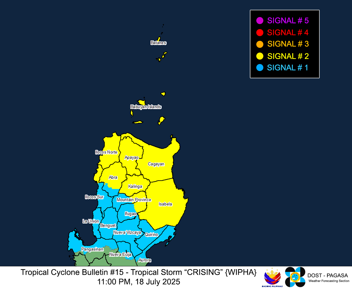
Image/Screenshot Source: DOST-PAGASA (https://www.pagasa.dost.gov.ph/tropical-cyclone/severe-weather-bulletin)


