TROPICAL DISTURBANCE (LPA) 96W STORMWATCH NO. 01Issued at: 6:00 PM PhT (10:00 GMT) Sunday, 20 Oct 2024
Next update: 6:00 PM PhT (10:00 GMT) Monday, 21 Oct 2024 or earlier |
|
|---|---|
| Current Status and Outlook |
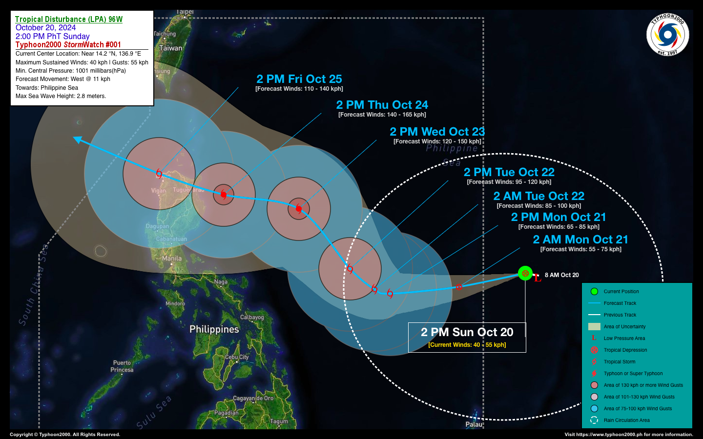
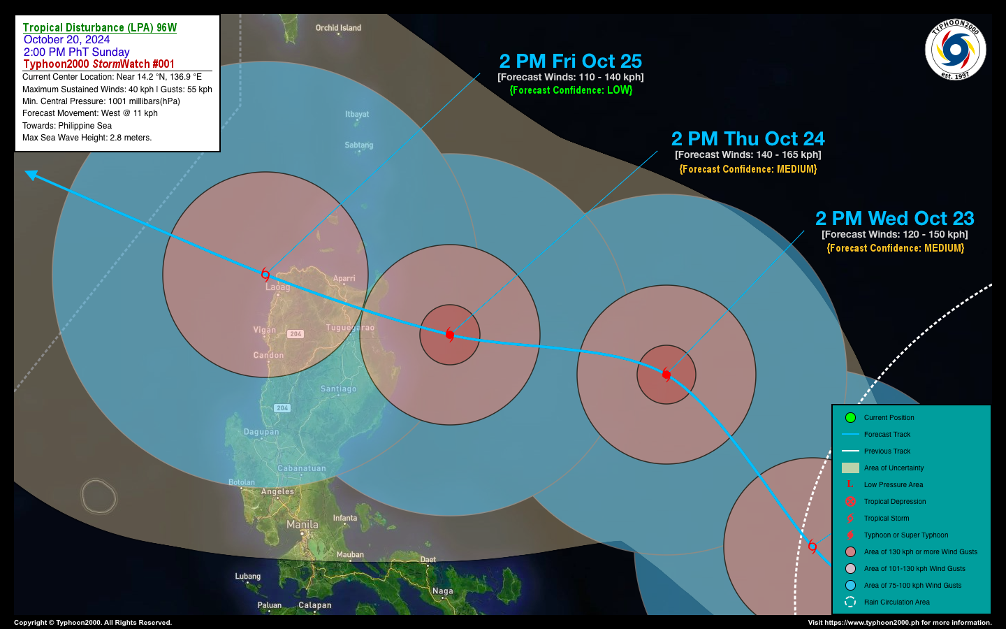
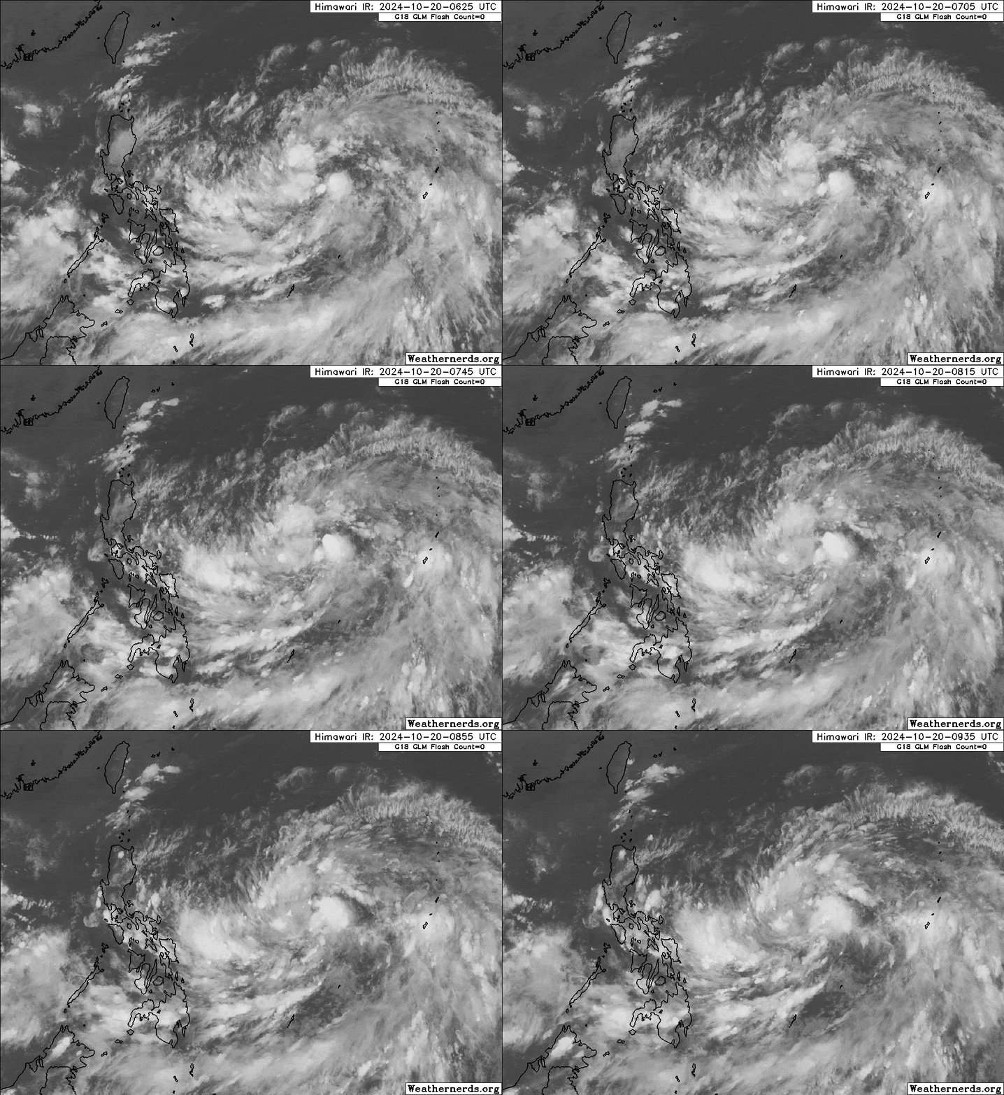
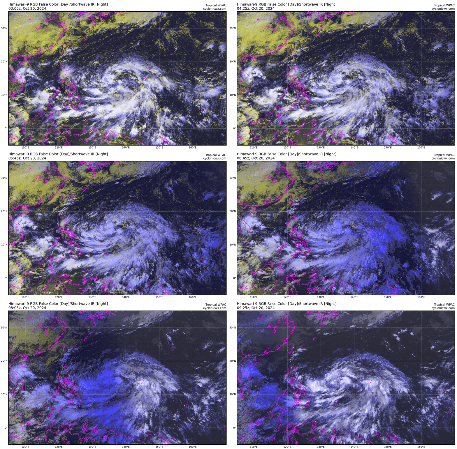
A large tropical disturbance, extending from west of Guam to the east of the Philippines, has been tagged as “96W.” It is expected to develop into a tropical cyclone within the next 6 to 24 hours and is projected to enter the Philippine Area of Responsibility (PAR) tomorrow, October 21. Once it reaches tropical depression status, it will be locally named “KRISTINE” by PAGASA, becoming the 11th tropical cyclone of the 2024 season. Current forecasts, though with low confidence, suggest it may approach Extreme Northern Luzon by Thursday, October 24. In the meantime, the disturbance outermost circulation has begun enhancing the Northeasterly Monsoonal Flow (Amihan) across the eastern sections of Luzon, including the Bicol Region, where intermittent rains and strong winds are expected today and tomorrow. |
| Where is LPA 96W? | As of 2:00 PM PhT today, October 20…0600 GMT:
|
| How strong is it? | Maximum Sustained Winds (1-min avg): 40 kph near the center…Gustiness: 55 kph. |
| Past Movement (06 hrs) | West @ 11 kph, towards the Philippine Sea. |
| Forecast Highlights |
|
| This StormWatch is valid for the next 24 hours.
Information based on data collected by Typhoon2000 (T2k) shall not be taken as official data. Weather information broadcasted and distributed by PAGASA remains as official data. Typhoon2000 (T2k) shall not be responsible for the private use and reliance of its weather information. |
|
Issued by: David Michael V. Padua for Typhoon2000 (T2K)


