TROPICAL DISTURBANCE (LPA) 92W STORMWATCH NO. 01

Issued at: 2:00 PM PhT (06:00 GMT) Saturday, 31 Aug 2024
Next update: 2:00 PM PhT (06:00 GMT) Sunday, 01 Sept 2024
Current Status and Outlook

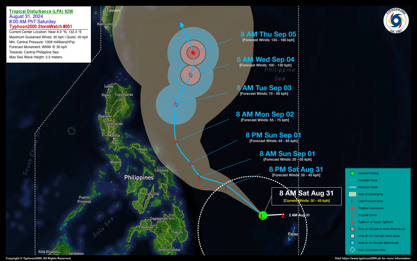
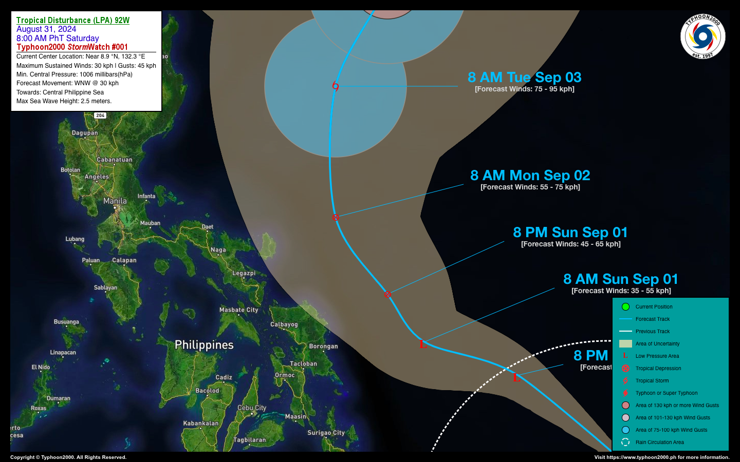
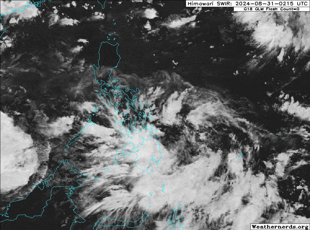
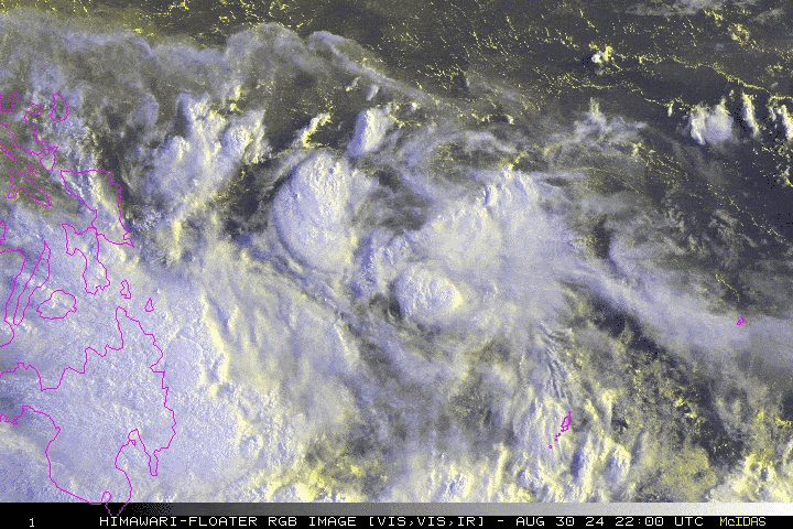
A new tropical disturbance or LPA, designated Invest 92W, is forming over the Philippine Sea, well within the Philippine Area of Responsibility (PAR). Global Typhoon Models predict that it will strengthen into a tropical cyclone between September 1 and 2, with a trajectory that may threaten the coastal regions of Eastern Luzon next week. Additionally, this disturbance is expected to intensify the Southwest Monsoon (Habagat) from September 2 to 8, potentially bringing occasional rains and thunderstorms to the western parts of the country.

Where is LPA 92W? As of 8:00 AM PhT today, August 31…0000 GMT:

  • Location of Eye/Center: Over the northern portion of the South Philippine Sea (near 8.9°N 132.3°E)
  • Distance 1: 665 km east of Bislig City, Surigao Del Sur
  • Distance 2: 1,025 km east-southeast of Virac, Catanduanes
  • Distance 3: 1,375 km east-southeast of Metro Manila
How strong is it? Maximum Sustained Winds (1-min avg): 30 kph near the center…Gustiness: 45 kph.
Past Movement (06 hrs) West @ 28 kph, towards the Central Philippine Sea
Forecast Highlights
  • LPA 92W is forecast to become a Tropical Depression (TD) either tomorrow, Sept 01 or on Monday, Sept 02.
  • The 48-hour Forecast shows the system passing along the coastal waters of Catanduanes or about 185 km ENE of Virac on Monday morning (8 AM Sept 02).  This is the closest point of approach (CPA) to the island province, based on the current forecast.
  • The rainbands of this LPA will bring 50 to more than 100 mm of rainfall across Bicol Region incl. Polillo Islands especially Catanduanes beginning Sept 01 to 03 (Sun to Tue).
  • During the passage of LPA 92W across the Philippine Sea from September 1 to 8, it is expected to enhance the Southwest Monsoon (Habagat). This will bring intermittent monsoon rains and severe thunderstorms to the western parts of the country, including the Ilocos Region, CAR, the western sections of Central and Southern Luzon, Metro Manila, as well as MiMaRoPa, Western Visayas, and the Zamboanga Peninsula. 
  • The risk of flooding and landslides during the onset of the monsoon will be high.
  • Once this system becomes a TD, it will be named by DOST-PAGASA asENTENG.”
This StormWatch is valid for the next 24 hours.

Information based on data collected by Typhoon2000 (T2k) shall not be taken as official data. Weather information broadcasted and distributed by PAGASA remains as official data. Typhoon2000 (T2k) shall not be responsible for the private use and reliance of its weather information.

Issued by: David Michael V. Padua for Typhoon2000 (T2K)

CONTACT US

We're not around right now. But you can send us an email and we'll get back to you, asap.

Sending

©2024 Typhoon2000.

Log in with your credentials

Forgot your details?